The Forestry Commission
Keystone Ecology tendered for and won the North and West Scotland Regions of The National Forest Inventory (NFI), a large scale data capture project that has been undertaken by the Forestry Commission on a regular basis since the 1920’s. The current NFI will provide the most comprehensive data on Britain’s woodland ever recorded and the data gathered will provide information on the changes in woodland type and usage from previous NFI’s, as well as information on the current state of Britain’s woodlands.
Data from the NFI will provide valuable information to government bodies, researchers and the private sector. For example:
- Data extracted from the NFI will feed into woodland planning and management
- The timber industry will benefit from more accurate long term timber forecast
- Researchers will be better able to model the effect of climate change on UK woodlands, as well as quantifying the role woodlands play in carbon sequestration
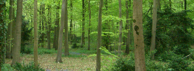
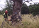
The NFI involved locating and surveying allocated 1 hectare squares of woodland dispersed across the region. Once a survey site was located the plot was divided into sections based on habitat type and land usage. A general assessment was then made of each section within the plot followed by mensuration assessments. Data collected included habitat types, tree height and number of storeys.
The survey sites were widely dispersed across the region and getting to them was quite challenging, involving driving on forest tracks and hiking cross country.
This entry was posted in Case Studies, Ecology, Forestry and Rural. Bookmark the
permalink. Both comments and trackbacks are currently closed.







National Woodland Survey
The Forestry Commission
Keystone Ecology tendered for and won the North and West Scotland Regions of The National Forest Inventory (NFI), a large scale data capture project that has been undertaken by the Forestry Commission on a regular basis since the 1920’s. The current NFI will provide the most comprehensive data on Britain’s woodland ever recorded and the data gathered will provide information on the changes in woodland type and usage from previous NFI’s, as well as information on the current state of Britain’s woodlands.
Data from the NFI will provide valuable information to government bodies, researchers and the private sector. For example:
The NFI involved locating and surveying allocated 1 hectare squares of woodland dispersed across the region. Once a survey site was located the plot was divided into sections based on habitat type and land usage. A general assessment was then made of each section within the plot followed by mensuration assessments. Data collected included habitat types, tree height and number of storeys.
The survey sites were widely dispersed across the region and getting to them was quite challenging, involving driving on forest tracks and hiking cross country.